


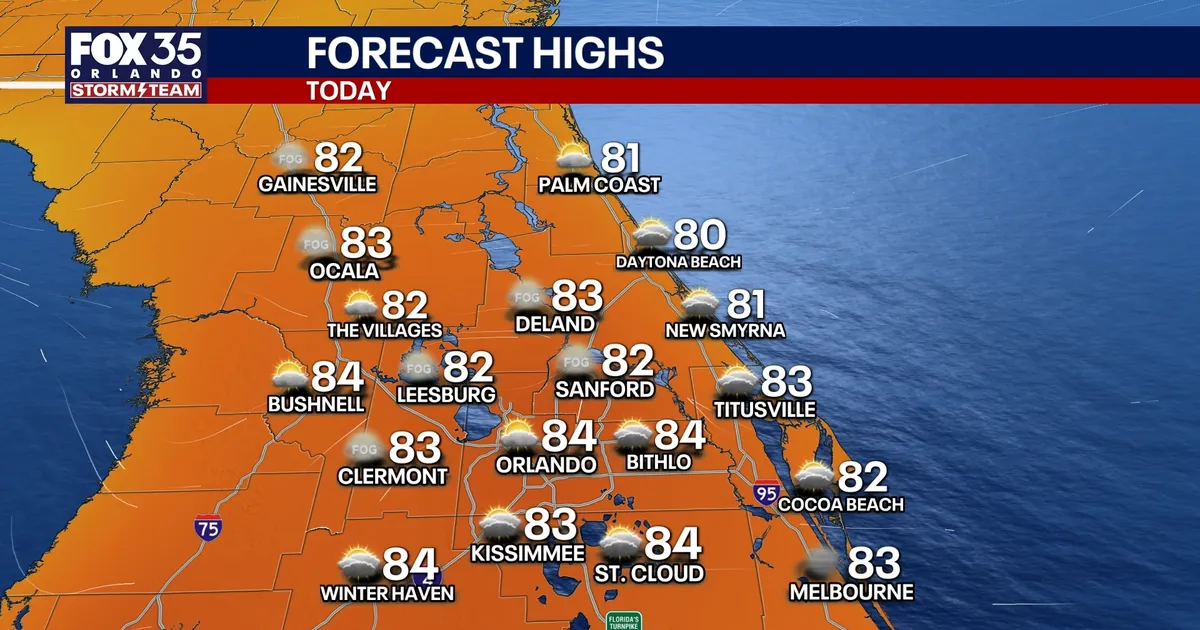
Orlando is set for another warm day before a powerful cold front brings a sharp change in conditions across Central Florida later this week, FOX 35 Storm Team meteorologist Brooks Garner said.
Temperatures on Tuesday morning began in the 50s and 60s, with some residents likely to need a light jacket. By the afternoon, however, highs are expected to climb towards the mid-80s.
Rain will be limited, with only a 20 per cent chance of a brief shower during the afternoon.
Showers and storms expected from Wednesday
Conditions will become more unsettled on Wednesday and Thursday as scattered showers and a few thunderstorms move into the region.
The chance of rain is forecast to rise to 40 per cent on Wednesday and stand at about 20 per cent on Thursday. Most activity is expected after lunchtime and could continue through the afternoon and into the evening.
Although widespread severe weather is not anticipated, forecasters warn that one or two storms could become strong enough to produce damaging wind gusts and hail.
Thursday’s showers are expected to become more isolated, particularly south of Orlando. Winds will also strengthen, with gusts of between 20mph and 25mph possible as the cold front approaches.
Cold front to bring weekend chill
The front is expected to cross Central Florida late on Thursday night, bringing much cooler air for Friday and the weekend.
Friday’s high is forecast to struggle out of the 60s, followed by a chilly and breezy weekend. Morning temperatures could fall into the 40s on both Saturday and Sunday.
North-westerly winds may make it feel colder, with wind chills dropping into the upper 30s and low 40s in some areas.
Despite largely sunny skies, afternoon temperatures will remain below normal. Orlando is expected to reach about 64F on Saturday before a modest recovery to around 71F on Sunday.
